DX Atlas 2.41
Electronic World Atlas for Amateur Radio
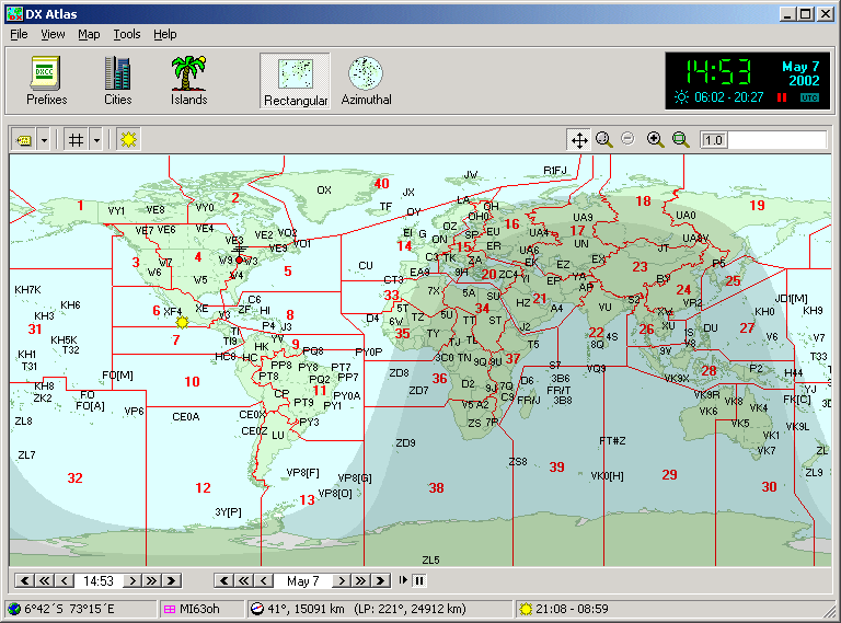
Electronic World atlas for Radio Amateurs. Scrollable World map with smooth zoom,
DXCC territories,
province/state prefixes, Grid Squares, CQ and ITU Zones in the rectangular,
azimuthal and Globe projections, 3D relief, Gray Line, city and island index, unique hierarchical
prefix database, local time with DST for all cities, islands
and call areas, unique ionospheric maps.
Integrates with
HamCAP,
IonoProbe,
Band Master,
and many 3-rd party programs.
 Prefixes Prefixes
Call area boundaries and prefixes are shown on the World map in addition to
the DXCC boundaries and prefixes.
Each prefix has a hint with a country and province name.
Click on a prefix to find it in the Prefix Database.
Zones
CQ Zone and ITU Zone boundaries can be switched on
and off. Move your mouse over the zone label to see the official
definition of the zone.
Grid Squares
The Maidenhead Locator map displays 2-character and 4-character grid squares.
You can mark worked and confirmed squares and add comments to each square.
The Grid Square calculator converts between the latitude/longitude and the grid square locator.
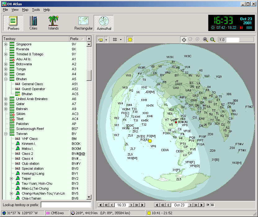
Azimuthal map
Rectangular, Azimuthal and Globe projections are available.
The Azimuthal map center can be changed with a single mouse click
to see how the World looks from a DX location.

Navigation
Zoom in and out, scroll or re-center the map, switch between the
projections and turn individual layers on and off with your mouse.
Antenna bearing and distance for the point under the mouse cursor
are shown on the status bar.
Gray Line
can be turned on and off, or shown for any specific date and time.
Sunrise and sunset time is calculated automatically for the current point
and for all gazetteer entries.
Prefix Database
Browse the visual, hierarchical prefix database that comes with DX Atlas.
This database includes current and old prefixes of countries and provinces,
prefix blocks allocated to club stations and reserved for special events,
and much more. Each entry has a lot of associated data, including
CQ/ITU Zone, Time Zone, DXCC territory and ADIF number.
We have released our Prefix Database as a public domain dataset.
Gazetteers
DX Atlas includes a detailed City and Island index.
Double-click on any island or city to find its location
on the map, or right-click to see the details such as
latitude and longitude, country, province, and city population.
Local time
is displayed for all territories, provinces and cities,
for the current date/time and for the dates in the past and future.
This function uses a database of Time Zone and DST changes since 1945.
Automation
3-rd party programs can control DX Atlas and even plot their own data on the map
via COM or OLE Automation.
Minimum system requirements:
- CPU: Pentium 166 MHz
- RAM: 32 Mb
- OS: Win95/Win98/WinNT4/WinME/Win2000/WinXP/Win7/Win8/Win10
- Video card: 640x480, 256 colors
- Disk space: 65 Mb
Copyright © 1998-2020 Afreet Software, Inc.

|